Environmental Impacts on the Roaring Fork Watershed
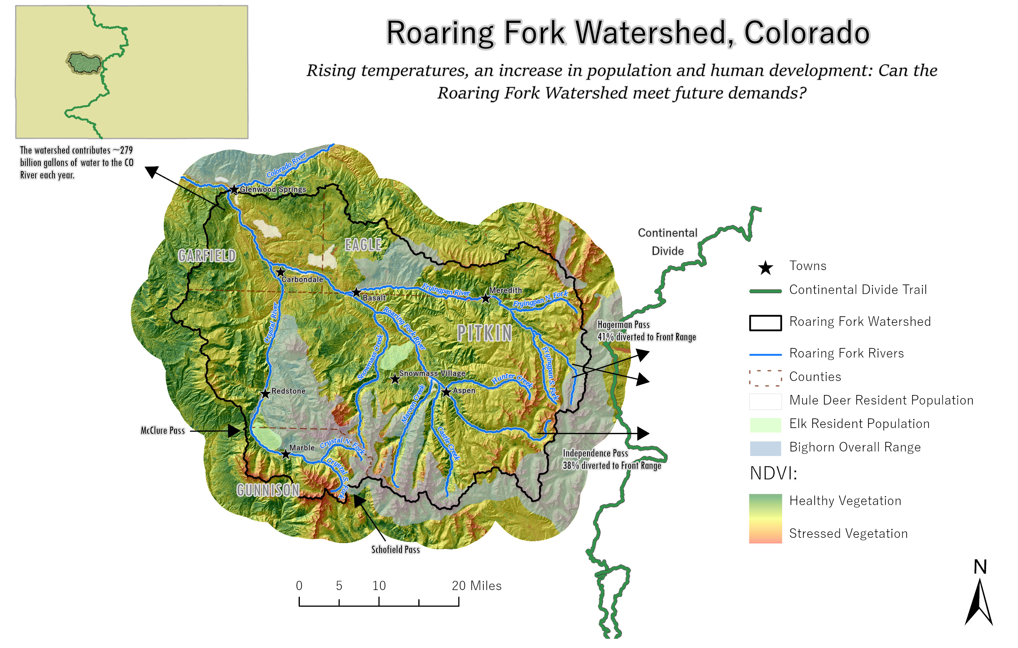
Calculating Normalized Difference in Vegetation (NDVI) using Landsat 8 Imagery. Can the Roaring Fork Valley keep up with the demand of water from outside sources with our ecosystem?
I am a student working toward my GIS Certification. I am building my skills in cartography, spatial analysis, remote sensing, and collecting my own field data... just to name a few! Thank you for looking at my website, I hope you enjoy it.
Calculating Normalized Difference in Vegetation (NDVI) using Landsat 8 Imagery. Can the Roaring Fork Valley keep up with the demand of water from outside sources with our ecosystem?
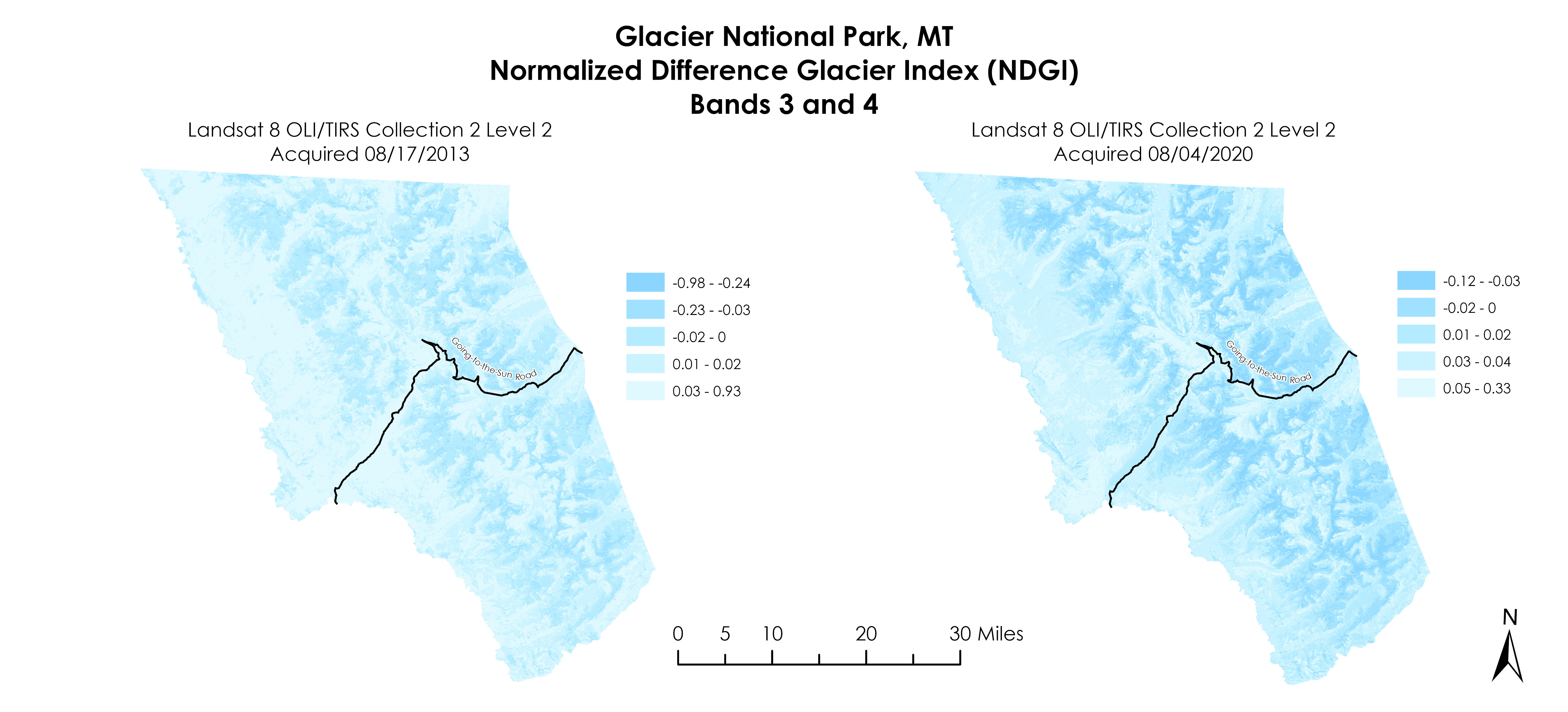
Normalized Difference Glacier Index (NDGI) from August 2013 to August 2020 using Landsat 8 OLI/TIRS Collection-2 Level-2. How long until there are no glaciers left?

With the Roaring Fork Watershed experiencing dryer summers and less snow fall in recent years, LST shows the thermal radiance from land surface in 2021. Created using MODIS data and Google Earth Engine.
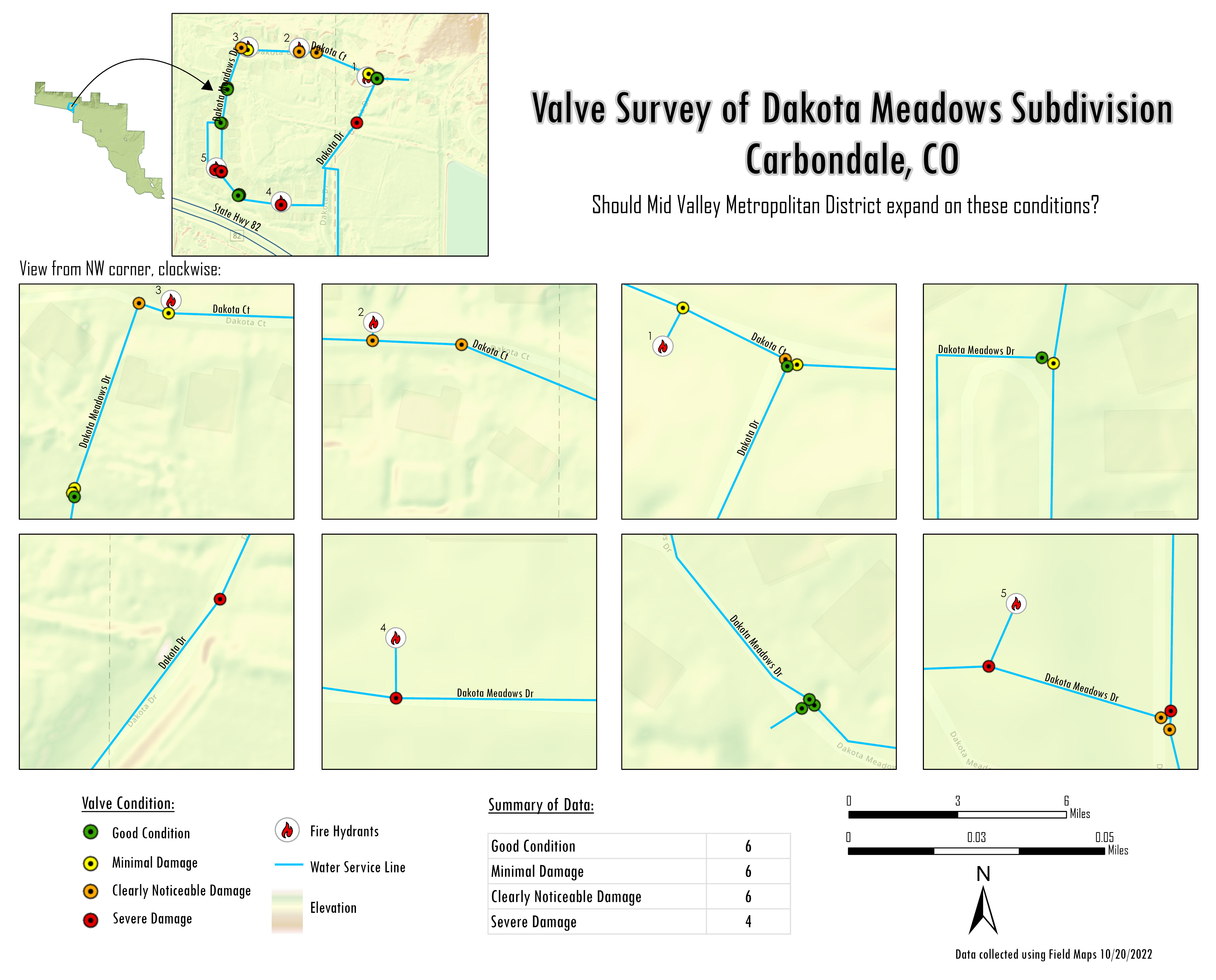
Created by collecting my own field data and exporting to ArcGIS Pro. This neighborhood is prone to water pipe and valve disasters. Perhaps this could be remedied by improving the infrastructure!
Please feel free to contact me with any questions regarding my work!